Practice
 Yogi Berra said, “In theory, there should be no difference between theory and practice, but in practice, there is” (or maybe he didn’t; and apparently he once said, “I didn’t really say everything I said”). This website cannot teach the actual practice of celestial navigation; however, by reading these pages, you should be able to move on to an on-site or correspondence course with an understanding of what you are doing. If you are new to Celestial Navigation, read at least the Theory and Navigational Astronomy pages first.
Ed Falk’s awesome page working out a sample “leg” from the Silicon Sea series of problems. Crystal clear, complete with plotting sheets and everything you need to see a problem worked out in detail!
Check out this amazing website: “Interactive Spreadsheets for Celestial Navigation.” Everything you need in free spreadsheet form!
A on old tutorial from Dutch Dresser is still available at the Internet Archives (the Wayback Machine) here.
Just about everything on theory and practice is in Bowditch’s American Practical Navigator Online. The practice of some early techniques of latitude finding and navigation without instruments can be found in the books Latitude Hooks and Azimuth Rings, and in David Burch’s magnificent Emergency Navigation, which everyone should own (it’s not just for emergencies!). Bowditch has a chapter on emergency navigation as well.
SIGHT REDUCTION: WHAT YOU WILL NEED
 You will need a sextant, a watch, a current-year Nautical Almanac (or see Omar Reis’s Almanac) and the Tables of your choice, HO 249 or HO 229 – air or marine sight reduction tables. For shooting stars, a Star-Finder would also help; you can buy the 2102-D, a kind of modern planispheric astrolabe, and there are some online, such as – once again, and what would we do without him? – Omar Reis’s Starfinder. (See Products on the Resources page if you want to purchase almanacs, tables, or Star-Finders. Try Geoffrey Kolbe’s long-term almanac if you don’t want to buy a new one every year). You can also do sight reductions with a calculator – I think Starpath’s Starpilot is the best; check out the list of features -it’s much more than a calculator and can be linked to your PC – but learn to do them with just a pencil and paper first. NOTE: You can take sights with an artificial horizon if you aren’t near the water. Check out the Product places on the Resources page. Be sure to read the instructions; you have divide the angle by two when using an artificial horizon. You can also make one by using a flat pie pan filled with water, or preferably oil. NOTE: The sextant can only measure up to 60 degrees with an artificial horizon and so cannot be used at all latitudes.
WHAT YOU ARE DOING:
With the modern “intercept” method, you will be comparing the position you think you might be in (from dead reckoning on a boat, or other data on land) with what you actually observe. Your observed altitude (steps 1-3 below) is compared to a calculated altitude (steps 4-5) – calculated to be what altitude you would get if you were actually at the position you chose as your assumed position. Therefore, you must both observe an actual altitude with the sextant; and figure, on worksheets and with the Tables, what the altitude would be if seen from the assumed position.
Remember: Noon (meridian) sun sights and Polaris sights do not require the Tables to solve the Navigational Triangle. See Theory.
NOTE: Your sextant must be corrected first. The sextant is a precision instrument, but like a bathroom scale can be off, either up or down. See John Jacq’s Corrections page under “Sextant Error,” or any of the books recommended below.
THE STEPS:
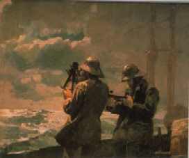
1. Setting up: deciding what celestial body you are going to “shoot” and when. This is especially important in star sights, as you only have the short time between civil and nautical twilight when the horizon is still visible, while some stars are bright enough to be seen. Civil and nautical twilight time are found in the Almanac for various latitudes. Find stars with Reis’s online Star-Finder. Or purchase the 2102-D Star Finder from Starpath. To find nautical and civil twilight, use the Navy’s one-year data page. Don’t forget to check the “type of table” you want (also has sun and moon rise and set).
2. Shooting the body and noting the exact time. (Your watch must be corrected if it is fast or slow on Universal Time – Greenwich Mean time – and corrected for your longitude east or west of the Greenwich meridian. You will be using UT (GMT) when you enter the Almanac. Check your watch against the Navy’s Master Clock.
3. Correcting your sextant shot for various corrections such as your height of eye above the horizon, your sextant’s index error, altitude corrections etc. Some of these corrections are in the Almanac; the others depend on you and your instrument. These are found in tutorials; see, for example, Chapter 2 of Henning Umland’s. (Chapter 2 is a PDF file available after clicking on Introduction and scrolling down). THIS WILL GIVE YOU YOUR OBSERVED ALTITUDE.
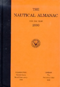
 4. Entering the Nautical Almanac for the body’s data at that precise time. The Almanac gives data for each hour of every day, with extra pages where you can find the minutes and seconds. There are some corrections to be made here. (Print Almanacs are available from the Products places on the Resources page), notably the “v” and “d” corrections. If you purchase one, make sure the Almanac looks like one of these (I have a commercial edition that is slightly different, but still with a blue cover). In six marine stores out of six, when I asked for the Nautical Almanac this year, I was handed Reed’s or worse, Eldridge’s (mostly tide tables!). Neither of those has all the information you need. These are the American versions; the orange is the hardcover government edition.
 5. Entering the Tables for sight reduction with the a) Local Hour Angle, (found by correcting the body’s Greenwich Hour Angle from the Almanac for your particular assumed longitude), b) your assumed latitude (see Find your latitude and longitude if doing this on land), and c) body’s declination (from the Almanac) to find the calculated height of the body if you were where you assumed yourself to be. (The sight reduction tables for Air Navigation – HO 249 and the Marine Navigation – HO 229 tables have been removed from the web. I will continue to search for online versions). Hour angles are defined on the Astronomy page. THIS WILL GIVE YOU YOUR CALCULATED ALTITUDE as well as the true bearing of the body.
6. Comparing the altitude you got – the OBSERVED ALTITUDE – with the CALCULATED ALTITUDE from the tables and deciding whether you are closer or farther away than the calculated position. (If the calculated altitude is greater, you are farther away from the assumed position; if it is less than the corrected sextant altitude, you are closer; the difference between the two is the number of nautical miles by which you need to change your assumed position).
7. Plotting the line of position. Two or more give you your fix – where you are. (see Ed Falk’s plotting sheet page).
Many of these steps are very easy and automatic once you have a worksheet with all the steps and spaces for corrections. It becomes simply a matter of filling in the spaces, and adding and subtracting. Ed Falk also has a sample worksheet – Hs is the height you get with the sextant; IE is the sextant’s index error; Hc is the calculated height from the tables, etc.
There are also PDF worksheets available on the Reader Page sent in by reader Harold Arsem.
The resources below will help:
CLASSES AND HOME STUDY
The very best place to get a real grip on the practice, in my opinion, is by taking a good course with an expert, especially one that gets you out on the water or at least to a horizon line. If there isn’t a school or teacher near you, the course available from the Starpath School of Navigation is the best. I took this course and I cannot say enough good things about it, or recommend it more highly. The price is absolutely amazing considering that some places want to charge hundreds of dollars for a single weekend. If you work your way through the text and problems, and take advantage of the fact that the price of the course includes phone calls and emails with one of the world’s top instructors, and navigators**, you’ll see they’re practically giving it away, and you’ll learn everything you need to know, and more.
**Don’t take my word for it – ask the Royal Institute of Navigation.
ONLINE TUTORIALS
NEWLY REDISCOVERED (thanks to “Harry’s Little Corner of the Internet”)!!! There is a great online tutorial by Al Placette that walks you through much of what is needed for reducing a sight by H.O. 229, including digitized parts of the Nautical Almanac to show you how to make v and d corrections. (The “v” is an extra correction for additional longitude movement of the body, and “d” is an extra correction for additional declination movement. The sun has no “v” correction and the stars have no “v” or “d” correction. The sun needs the “d”, and the planets and moon need both “v” and “d”). One of the best on the Net.
Another really excellent site is Umland’s Short Guide to Celestial Navigation. Parts are really for advanced students, but there is plenty for beginners, including very clear graphics. Scroll through the chapters and look them over, and check out Chapter 2 on how to make all the various sextant corrections. There is also an extensive collection of freeware – a Sun and Moon Almanac, Sight Reduction Calculator, Fix Calculator, and more – on his Freeware page. Another of the best on the Net.
OTHER HELP
Join the Foundation for the Promotion of the Art of Navigation and you can write to their journal and get expert advice. There are also detailed articles on all aspects of navigation and its history. [MEMBERSHIP CURRENTLY INACTIVE BUT MAY BE REVIVED IN THE FUTURE].
The Navigation List is an email list for traditional and electronic navigation; check the archives for technical questions, or join and ask one. Here is their archive site.
 William F. Buckley, Jr., has a great chapter on how to do sun sights in his book on a transatlantic crossing by sail, Airborne: A Sentimental Journey (1970). It is unfortunately out of print, but you can usually find it at libraries. It’s about 18 pages long, uses the Air Almanac, and is concise and clear (I know, I know; but no, he doesn’t use his $1,000-a- word vocabulary here). An added bonus is that his son Christopher went on this trip, and his log entries show that he was already, at that age, a writer in his own right. Whenever a wine bottle was emptied, it was the custom on the boat to write an anti-Communist message and send it to sea in the bottle. One of Christopher’s submissions: “Man is born free, and everywhere he is running out of Branc-Cantenac.” (all politics aside, this is still very witty!). I haven’t seen his video, but I’ll bet it covers the same ground as this chapter.
Books:
There are many, many books on the practice of celestial navigation – do a search at Amazon.com and you’ll see. These are my favorites:
Practical Celestial Navigation by Susan P. Howell. Mystic Seaport also has this. It is actually a course, and everything you need (copies of necessary almanac pages and sight-reduction tables) is in the book.
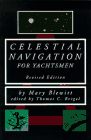 Celestial Navigation for Yachstmen by Mary Blewitt. This book is short and to the point, and many people swear by it.
Online Almanacs, Starfinders, Latitude-Longitude Finders, and Programs for Sight Reduction
- H.Umland’s Freeware Page
- JavaScript Programs for Navigators by Jacky Wong
- Omar Reis’s Navigation Star Finder
- Omar Reis’s Online Nautical Almanac
- Omar Reis’s Navigator Light Computer Program
- W.Fendt’s Apparent Position of a Star Astronomy Java Page
- Almanac and Sight reduction Information from the Navy
SOFTWARE
Pocket Stars Integrated Star Chart, Ephemeris, and Celestial Navigation Software for the Pocket PC.
ASNAv, “designed by a seaman for seamen.”