CelNav in the Classroom
Science and Math | Projects | History | Reading | Literature | Books
I have found that students of all ages quickly become interested in celestial navigation, as it provides a concrete link between the heavens and themselves, one that fills some of them with awe and amazement. It is a subject about which most of them know nothing at all, so it has the added attraction of novelty. At some simple level – basic orienteering and latitude finding – they can very easily learn to do it themselves. Older students can learn to use the sextant. And even most adults have an extremely limited understanding of astronomical or navigational metaphors, so whole new worlds open up to them once the original use behind the metaphor is grasped.
SCIENCE AND MATH CLASSES

Astronomy classes are the most obvious place to start. It always amazes me how little most students know about the sky – usually they can identify the Big Dipper and Orion but little else. I think the all-time best book for explaining the astronomy you need for understanding celestial navigation is H.A. Rey’s The Stars: A New Way to See Them. Yes, that’s the same H.A. Rey that gave us the “Curious George” children’s books. Not only does the book redraw the constellations so that they look like what they are called, and so are very easy to find, but it has crystal-clear illustrations that explain why sidereal time is off solar time by four minutes; just what declinations and hour angles are; the ecliptic; the precession of the equinoxes and why Polaris hasn’t always been the North Star; the celestial coordinate system, and more. Highly, highly recommended for anyone of any age.
See also the Navigational Instruments page and the Navigational Astronomy page for further resources.
EYES ON THE SKY, FEET ON THE GROUND – From the Smithsonian Astrophysical Observatory. Chapter 4 has Coordinate System and Celestial Mapping activities for children include an astrolabe and star plotter, finding your latitude, etc. Scroll down to topics three and four.
CULTURAL ASTRONOMY – don’t miss this completely unique (yes, I know that’s redundant!) site from Helmer Aslaksen.
ASTRONOMY WITHOUT A TELESCOPE by Nick Strobel – terrific notes and diagrams – everything you need for “naked eye” astronomy, and hence celestial navigation! Don’t miss this site!
Lesson Plan
for NAVIGATING AROUND THE WORLD BY OBSERVING THE SUN – from the PBS Nova series.
Also, be sure to check out Nova’s Shockwave Game on Finding Your Longitude.
Math: Celestial navigation in its modern form is based on solving spherical triangle problems (the “navigational triangle”) and there is a good site for Navigational Trigonometry, but your students don’t have to be taking trigonometry to use celestial navigation. Finding latitude by the meridian passage of the sun or by Polaris only requires addition and subtraction, as does sight reduction using pre-calculated tables. (If you do want the trig, try the advanced tutorial that H. Umland has online: Umland’s Short Guide to Celestial Navigation).
PROJECTS
Online Projects:
- How to Make a Quadrant
- Measuring North Latitude at Night
- How to Use a Cross-Staff
- Build Your Own Sextant
- Finding Latitude by Polaris (historically)
The Royal Astronomical Society of Canada has a “make your own planisphere” (starfinder) lesson. You need a PDF reader to download the templates.
Build and use 18 navigational tools: Latitude Hooks and Azimuth Rings: How to Build and Use 18 Traditional Navigational Tools

KITS: Celestaire sells kits for making a working nocturnal, astrolabe, and mariner’s astrolabe, made of heavy cardboard stock coated with a metallic gold finish. They also make a sundial and perpetual calendar. I have made all these things, and they work. NEW – the new Celestaire catalogue has a kit for a laminated cardboard sextant with mirrors and adjustable sun shade! I haven’t tried this one yet, but I will. There is nothing like building a working model to really show kids how something works!
HISTORY
First, be sure to check the History page!
You can do classes that the cover latitude sailing during the Age of Exploration; with no sure-fire way to figure longitude, it was safer to sail up or down the coast until you reached the latitude of your destination (as shown by the taking the altitude of stars), then sailing east or west. Supposedly old sailing directions to the Caribbean were, “Sail south till the butter melts, then west.” Then there is the history of the Longitude problem (Longitude: The True Story of a Lone Genius Who Solved the Greatest Scientific Problem of His Time) and the invention of the chronometer, for a unit on time. See John Harrison and the Longitude Problem. To understand the Middle Ages and the Ptolemaic view of the universe, I would strongly suggest C.S. Lewis’s underused classic, The Discarded Image: An Introduction to Medieval and Renaissance Literature
, for high school or college students.
- Teacher’s Guide to Teaching Longitude – from PBS, with resources. A transcript of PBS’s video Lost at Sea is here. See also The Secrets of Ancient Navigation.
- Navigation During the Time of Columbus
- Secrets of Ancient Navigation – PBS on the Phoenicians, Norsemen, Chinese, etc.
- Latitude: The Art and Science of 15th and 16th Century Navigation – Excellent site for students with many informative links; see for example the link for pre-1400 navigation
- The Age of Exploration from the Mariner’s Museum
- Determination of Latitude by Sir Francis Drake – a page by Bob Graham.
- Longitude at Sea from the Galileo Project
- Discoverer’s Web (from the Internet Archive)
American History
 Why isn’t there more online about Nathaniel Bowditch? This Salem resident was entirely self-taught in mathematics and astronomy (and taught himself Latin so he could read Newton’s Principia), and had such a great effect on celestial navigation that his book, The American Practical Navigator (originally published in 1802), is still called “Bowditch” after many revisions. A children’s biography is available (see under Reading, below) and online are:
Short Biography of Nathaniel Bowditch – I had to go to the United Kingdom for this one!
Did you know that slaves in the Underground Railroad used celestial navigation? The following is from the description of a video I have not seen from NASA and the National Park Service called The Underground Railroad: Connections to Freedom and Science; their underground railroad page is here, though the video seems only to be available at vimeo.
“Slaves traveling the Underground Railroad, usually on foot, depended on celestial navigation to find their way northward. They continually looked to the Big Dipper and the North Star for direction. The purpose of this video is to increase student awareness of the Underground Railroad and the role celestial navigation played in the Railroad’s success.”
American explorers Lewis and Clark used celestial navigation. There is a good article here taken from the Spring 2000 Issue of f the Institute of Navigation’s online journal. A short article on Formal Navigation by Lewis and Clark, and a series of links on their celestial navigation are available at the excellent Lewis and Clark site at www.lewis-clark.org.
NEW BOOKMARK AND MUCH MORE INFORMATION A reader has suggested a link on David Thompson, who explored and mapped Western Canada and the Northwest of the US from 1790-1812, using a sextant and compass. This link includes ten detailed articles from the issue of Northwest Journal devoted to 19th century navigation.
Viking Navigation
The Vikings are enjoying a bit of a Renaissance lately, in print and on the web, and in events such as the new Viking Exhibit now at the Museum of Natural History in New York. Apparently the marauders were only a small subset of a very interesting society. Longships, sun compasses, the sagas of the Norse gods — the Vikings are always a favorite subject for classrooms. And no, they never wore horns on their helmets. See my Viking Navigation page, where there are books and websites available.
Non-instrument Navigation
There is a wealth of material on the Internet on Polynesian star navigation and non-Western navigation in general. Captain Cook was astounded at the advanced navigational skills of the people of the South Seas. See my page on Wayfinding. See especially the classroom activities at the Hawaiian Voyaging Society.
NATIVE AMERICAN:
There is also an interesting website called “Aboriginal (Native American) Astronomy” on star lore and Lakota astronomy.
READING
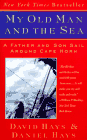
Once, to tempt a middle-schooler who did not want to read any books during the summer, I mentioned how Steven Callahan was able to navigate using a sextant made of pencils tied together and survived 76 days at sea. This student proceeded to devour Callahan’s account, Adrift: Seventy-six Days Lost at Sea (kids love harrowing adventure tales). In My Old Man and the Sea, a father and his teenage son sail around Cape Horn, using no electronic navigation devices – just a sextant and compass. Then there is a Newbury Award-winning, fictionalized account of Nathaniel Bowditch’s (see above) life and work called Carry On, Mr. Bowditch
by Jean Lee Latham.
 |
 |
 |
LITERATURE
My graduate thesis was on Dante, so I have a page just for him. Knowledge of celestial navigation and of the stars and constellations will enhance your students’ understanding of Melville, (and don’t forget the wonderful new novel, Ahab’s Wife, or the Stargazer) Conrad, Spencer, Ovid, Shakespeare, Pope, Milton, Longfellow, the entire Western canon, Arabic and other eastern literature…well, just about everything. Reading much of the world’s literature without a knowledge of these things would be like reading most Western literature of the past two thousand years with no knowledge of the Hebrew Scriptures and New Testament – a huge percentage of the allusions and metaphors would fly over your head. See also my Quotations page ( a work in progress). BTW, Chaucer’s History of the Astrolabe is online as well.
BOOKS
- Latitude Hooks and Azimuth Rings: How to Build and Use 18 Traditional Navigational Tools
by Dennis Fisher
- The Stars: A New Way to See Them
by H.A. Rey
- Longitude: The True Story of a Lone Genius Who Solved the Greatest Scientific Problem of His Time
by Dava Sobel
- Navigation in the Age of Discovery By Duane A. Cline
- Taking the Stars: Celestial Navigation from Argonauts to Astronauts by Peter Ifland
- Emergency Navigation by David Burch
- The Discarded Image: An Introduction to Medieval and Renaissance Literature by C.S. Lewis
- Carry On, Mr. Bowditch
by Jean Lee Latham
- Adrift: Seventy-six Days Lost at Sea
by Steve Callahan
- My Old Man and the Sea by David and Daniel Hayes
- Line of Position Navigation: Sumner and Saint Hilaire – the Two Pillars of Modern Celestial Navigation by Peter Ifland and Michel Vanvaerenbergh